Hetch Hetchy and Vicinity Trail Distances and Descriptions (All distances approximate and one way)
| Trail | Destinations | Miles | Km | Brief Description |
| Poopenaut Valley
|
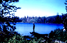
Poopenaut Valley | 1.5 | 2.4 | This trail provides quick access to the Tuolumne River descending approximately 1200 feet to the river below O'Shaughnessy Dam. |
| Miguel Meadow | Miguel Meadow | 7.5 | 12.0 | This trail follows the Beehive/Vernon trail to the top of the switchbacks and then turns west through forested terrain to Miguel Meadow and Lake Eleanor. |
| Lake Eleanor | 10.7 | 17.0 | ||
| North Mountain | 14.9 | 23.8 | ||
| Cherry Valley | 17.0 | 27.2 | ||
| Beehive Trailhead
|
Laurel Lake | 8.3 | 13.3 | This trail follows an old road as it switchbacks up the cliffs above Hetch Hetchy reservoir and then continues to ascend through the forest toward Beehive Meadow, Laurel Lake, and Lake Vernon. |
| Lake Vernon | 11.5 | 18.4 | ||
| Beehive Meadows | 7.2 | 11.5 | ||
| Wilmer Pass | 17.9 | 28.6 | ||
| Bond Pass | 27.5 | 44.0 | ||
| Benson Lake | 33.7 | 53.9 | ||
| Tuolumne via Benson Lake | 63.2 | 101.0 | ||
Rancheria
Falls Trailhead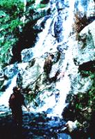 |
Rancheria Falls | 6.7 | 10.7 | This popular trail contours the cliffs above Hetch Hetchy reservoir taking day hikers to Wapama Falls and overnight hikers toward Rancheria Falls and into the canyons of the northwest portion of the park. |
| Tilltill Valley | 9.5 | 15.2 | ||
| Pleasant Valley | 18.5 | 29.6 | ||
| Glen Aulin | 40.0 | 64.0 | ||
| Vernon Lake via Tilltill | 15.0 | 24.0 | ||
| Cherry Lake Trailheads |
Lake Eleanor | 3.0 | 4.8 | These trails begin near Cherry Lake (a 1.5 hour drive from Highway 120) on the Stanislaus National Forest. |
| Kibbie Creek - Kibbie Lake | 10.2 | 16.3 | ||
| Kibbie Ridge - Kibbie Lake | 10.2 | 16.3 |
Tuolumne Trails , Tioga Road Trails
Wawona and Glacier Point Trails
http://www.nps.gov
File created 9/99 Hayes Roberts
Updated
Yosemite National Park Division
of Interpretation